I rolled over in bed and wondered what time it was. I hadn't heard my iPod beep so I figured it was still sometime before 3:00 a.m. I was just about to drift back into slumber when I detected the smell of brewed coffee emanating from the kitchen. I pressed the wheel on the ipod and scrolled over to the clock. 3:30 on the dot. I had planned on being awake at least 30 minutes earlier, but no matter. I got out of bed and within 30 minutes, I was backing out of the driveway and on my way north to the town of Florissant, Colorado for the 2nd annual Mountain Top Cycling Club's Experience Ride, a 106 mile event that includes several climbs up to around 10,000 feet (not to mention a few that aren't so high, but plenty steep).
While I don't really mind getting up early for a race, I prefer that it not be quite as early as this one. But with over an hour of driving, a need to pick up my packet, and a 6:00 a.m. start, there really wasn't much choice. There was some lodging in the area, but I was trying to make this a less expensive event (registration cost me about $30 bucks!). Fortunately, the drive was quiet at this hour and I made excellent time, arriving a little before 5:30. I even had time to get some gas for the car (something I figured would be more physically taxing after the ride).
 |
| The Grange Hall just prior to the start at 6:00 a.m. |
The first thing that I noticed when I stepped out of the car was that it was cold. Not just chilly, but cold (at least for my Pueblo standards). The temperature reading on my Cateye was registering at about 33 degrees. I wasn't really planning on cold weather apart from having my arm warmers with me. I dug around in my gear and found a plain white t-shirt (Hey there Delilah!) and put it on under my kit. That extra layer helped a lot. Shortly before six a.m., all of the riders gathered in front of The Grange Hall for a few announcements, and the national anthem. There was a long list of sponsors and several directions given. As I stood there, I began to shiver involuntarily. I was dying to get on the bike and get the blood flowing a little. When we were finally underway, I noticed that I felt fairly warm, with the exception of my finger tips, which had gone completely numb. I mean completely numb. At one point I pressed my index finger to my thumb, and I couldn't feel a thing!
Much like a running race, the first few miles went by quickly and easily. Everyone is fresh and there's a little more adrenaline that helps with the perceived exertion. Initially, I was tempted to "go" with a few of the more experienced riders, but I decided to hang back in the end. There wasn't really any pace line to join and I didn't want to exhaust myself trying to stay with any riders that were faster. Ride my own ride was the plan. After about 35 minutes of riding, we reached the first aid station at 9.5 miles. I felt just fine at this point, so I decided that there was no reason to stop. Ahead lay the first significant climb of the day that would take us up about 1500 feet over the next 7 miles.
 |
| Looking back down at the road up to Cripple Creek (about 15 miles into the ride) |
I settled in and began climbing, and at this point, my fingers finally warmed up which was a bonus. The sun also began to peak above the surrounding mountains. Before I knew it, I was riding past the city limit sign for Cripple Creek, and headed into town. Once again at 16 miles (the second rest stop), I was feeling fine so I skipped this stop as well. I figured I would try to skip a few of these so that I could rest a little longer at some of the other stops. This proved to be a pretty good approach for me and not having to unclip, stop, and get going again every 10 miles, probably saved me a good 15-20 minutes overall on the day.
The next landmark on the route was the town of Victor, Colorado which is about 10 miles south of Cripple Creek. These are often described as "old mining towns," and while that's true, there is still plenty of modern, active mining in the area.
 |
| Mining Operations near Victor, CO |
As I rode across from Cripple Creek to Victor, there were giant valleys and mountains created by these operations. At one point, I looked up to see a giant vehicle, way at the top of one of these hills. From a distance it looked like one of those giant Sandcrawler vehicles that the belonged to the Jawas in Star Wars.
 |
| Jawas not included! |
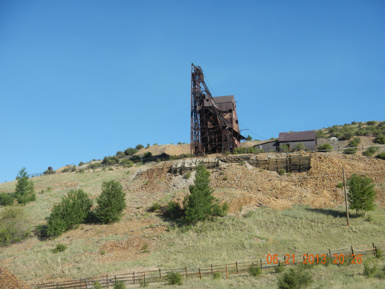
Still, even around some of the newer mining endeavors, you could see the remnants of the old mines here and there.
In the town of Victor, I decided to take a break at Rest Stop #3. Much like aid stations during a race, the rest stops included a mix of gatorade, water, gels, fruit, and other snacks. I was still feeling fairly energized, so I opted for just half a banana, and some water before moving on. I lingered a little longer at this aid station before it dawned on me that I'd only ridden about 23 miles, and I still had another 83 to go! Time to get moving.
The ride out of Victor was quite steep and brought us to the high point of the ride after two significant climbs. One of the things that I came to understand on this ride was that there would be a lot of "give and take" in elevation. It was common to spend several minutes riding up to the top of a steep hill, only to descend in less than a minute or two. At the bottom of these descents another hill would be there waiting to be climbed. As much as possible, I tried to take advantage of the opportunity to coast on the downhill portions so that I could rest my legs for the next hill. Coasting was fairly easy considering that the pitch on some of these hills was well over 7% meaning that my speed would be in the upper to mid thirties (mph) on the way down. Contrast that with climbing somewhere between 5-7 mph!
 |
| Old Mine on the way up and out of Victor |
Before long, the major climbing of the first half of the ride was finished (well mostly) and we were back in Cripple Creek. There was one hill in town that was extremely short . . . and extremely steep. I, underestimated this of course, and didn't get into a low enough gear in time for the climb up. I wound up having to stand and pedal with all my heart and soul to get to the top without falling over. After that, the next 10-15 miles was mostly downhill riding back down past the first two rest stops (which I also skipped). My plan was to ride to the stop at 50 miles before taking a little bit more of a break. Despite that the ride was mostly downhill, I could feel my energy starting to wane a bit. What's more, a headwind had picked up, and the smoke from the West Fork Fire complex began to blow our direction. A smoggy haze enveloped the valley that I was riding through, and there was the campfire smell of smoke in the air. At the bottom of this valley, I found rest stop #4, and gratefully unclipped from the bike.
 |
| The West Fork Fire Complex, a group of several Fires, is clouding much of Southern Colorado |
I spent nearly 10 minutes at this stop to do some major refueling. The Gatorade, peanut butter and jelly sandwiches, cups of trail mix; all looked and tasted delicious! I had caught up to a few of the riders that had gone by on their bikes, but most of them were back to riding before me, and I didn't see them again. The haze and smoke were even more noticeable in this little valley and the sun seemed to beat down even harder. All of which may have encouraged me to get back on the bike a little sooner than planned. I wasn't feeling particularly rejuvenated, but there was still half of the ride left. I steeled myself, and got back on the bike. The next 8 miles or so were the second longest climb of the day. In this section, I was definitely in a "dark place." The hills and the heat were draining all of my will, and it took every last effort to climb. I've noticed that with longer endurance events, that passing through these psychologically difficult times is fairly common. I've noticed that they do come and go, it's just a matter of patience. I gritted my teeth and pushed on.
About a mile out of the rest stop, I noticed a BLM fire vehicle and a couple of pickups parked on the side of the road. Peeking over the shoulder, it appeared that a small fire had burned a couple of acres at some point. I imagined that the fire personnel were doing some checking to make sure that it was completely out. It was a reminder about the fire danger that is present during these hot, dry months.
For the next several miles, I climbed and climbed. I would reach the top of one hill, only to find another waiting just ahead. A couple of other riders came past me at one point, and made me feel like I was standing still. They quickly faded in front of me. Finally, I reached the top of the climb and a fairly long downhill stretch led to the next rest stop, just a few minutes east of Highway 9. I stopped to take off my t-shirt and to refill my water bottle, but I chose to make it a quick stop as I worried that stopping too frequently would allow my body to move into rest mode, and make the rest of the ride more difficult. On to Guffey.
 |
| Theme for this ride: Climbing hills! |
The last "segments" of the ride are a bit longer for the most part ranging from 14 to 19 miles. The first part of the ride up Highway 9 wasn't too terrible. There was a slight tail wind which made it a bit easier to ride despite the slow steady climb. I figured that if I could keep that pace, I'd reach the next stop in just over an hour, tops. However, the last portion of this segment had other ideas. That's right, there was more climbing to be done, and it was exhausting. I reached Guffey and the sixth rest stop feeling completely spent after nearly and hour and a half. I wondered if the SAG wagon would be parked there. Part of me hoped that it would be.
Standing under the trees at the next rest stop, one of the other riders noted that it was "all kinds of hot" out on the road, and this was a perfect way to describe it. I drank a half bottle of Gatorade, and refilled my water bottles. There was an empty camp chair sitting right next to my bike, beckoning me. I resisted, and finally a fellow rider sat down in it. I regarded this with an equal mixture of jealousy and relief. After a slightly longer break, I got back on the bike and faced what was probably the worst climb of the day for me. It was very steep, and while only a couple of miles long, it took me a good twenty agonizing minutes to reach the top. At several points, it was all I could do to keep even a 3 mph pace, while standing up out of the saddle. There was also no shade at all, and the unrelenting sun beat down on my back and caused the sweat to pour down from my head. I couldn't even get a drink of water, as that would have caused me to slow even further, which was pretty much impossible to do. I pressed on but it was demoralizing and I wondered how on earth I was going to cover another 25 miles this way. The time on my bike computer said I'd been riding for about six and a half hours. I guessed it would be at least nine hours before I finished given the pace I was going.

With aching legs, I reached the top of the hill and enjoyed some downhill. I prayed that I would get a few more minutes of descent before the next climb appeared. In what seemed like a miracle, the downhill continued, and continued, and continued some more. Over the next 30 minutes, I enjoyed a long gradual descent and I kept a pace between 25 and 35 mph. It was a bit of a bumpy ride with ruts in the road about every 40 feet, but I didn't care as long as I continued downhill. It was absolutely rejuvenating! The next time I checked the distance on my computer I was already at 92 miles. Only about 15 more to go and I felt great for the first time in a few hours.
The last part of the ride passed quickly even though some of the uphill had returned. I found a groove and just pushed through each of these hills. I had energy, speed, and felt like I could ride another 50 miles (not saying that I wanted to, just that I could). I crossed the 100 mile mark after about seven and a half hours of riding time. I thought the last six miles would pass slowly and tortuously , but before I knew it, I was on the final hill down into Florissant, and as I rode to the finish, I was greeted with cheers and applause from the other riders and volunteers.
At the Grange Hall, everyone was in good spirits. There was a BBQ lunch and I greedily enjoyed a cheeseburger, chips, and a drink. I would have loved a beer, but it wasn't one of the available options, and in reality I don't think it would have been wise with a good 90 mile drive back home. That said, one of the sponsors for this event was the Paradox Brewery in Woodland Park. Paradox ages all of their beer in wine casks, and they specialize in adding a modern twist to traditional beer styles. On the way home, I stopped in and picked up a 750 ml of their Trippel Double, a Belgian style double IPA to enjoy once I was safely back at the house. It was excellent, and not overdone with the typical coriander and orange that a lot of Belgian Whites seem to have. Let's just say that bottle didn't make it through the night.

This year, I've opted to participate in some longer events in lieu of the usual round of triathlons (I'm still planning on doing at least a couple) in an effort to build my aerobic base. Back in May I did the CPTR 50 trail run, and next month I'm going to try my hand at a 2.4 mile swim race in Littleton. This century ride represents my longest bike ride to date. In terms of exertion, the a century ride seems to be about the equivalent of running a marathon. I would definitely considering doing this, or another century ride again although I'm not sure about a multi-day cyclingevent. Maybe with a little more T.I.T.S. (Time in the Saddle), it would be something I'd consider doing, but it's not on the radar for anytime soon.


 When the war finally ended, Bartali was able to return to cycling. However, he was no longer a young man, and many speculated that his best years were lost to the war. His temperament had changed as well, and he was considered by many to be aggressive and rude. During the 1948 tour, the media criticized him tirelessly, and as he fell behind by more than twenty minutes, it looked like his days as a professional cyclist were coming to an end. What happens next . . .well, if you don't already know, you'll just have to read the book.