Wednesday, June 26, 2013

Book Review: Road to Valor


This Saturday will mark the start of the 100th Tour de France.  I first became captivated by this race as a teenager back in the 1980's.  I remember following the race and the likes of Greg Lemond, Bernard Hinault, and Laurent Fignon as they battled throughout the second half of the decade.  And although I never had the chance to attend, each summer the Coors Classic bike race came to Colorado and generated excitement and enthusiasm for the sport.  I remember what it was like to be a "real" cyclist after purchasing a used Trek road bike from a neighbor. 
Lemond vs Hinault
 As I grew older, I took a long break from cycling (like nearly 20 years), but I remained interested in the Tour de France.  Like most everyone else in America, I felt a great sense of pride as Lance Armstrong raced to so many tour victories, and then a sinking disappointment as his pervasive cheating was uncovered.  When his multiple victories in the tour were vacated this past year, and no new winners were named (based on the fact that so many of the top riders were doping, it would be difficult if not impossible to say they had won cleanly), the whole endeavor seemed a farce, and hollow.  The Tour de France is arguably the toughest endurance race in the world, but what honor does it hold if the participants win fraudulently?
Lance's "confession" on Oprah
 It was with this frame of mind that I sat down to read Road to Valor: A True Story of WWII Italy, The Nazis, and the Cyclist who Inspired a Nation by Alli and Andres McConnon.  It is a story about endurance not only in athletics, but also of the human spirit.  The backdrop for the story is Italy in the late 30's and early 40's.  In this environment, a rising superstar Italian cyclist named Gino Bartali, born to a poor family on the outskirts of Florence, tries to pursue his dreams as a professional cyclist.  Standing in his way is the growing fanaticism of Benito Mussolini's fascist regime.  And as Italy falls deeper under the influence of Nazi Germany, Bartali, a non-fascist, finds his opportunities slipping away.  Before long, the shadow of World War II is cast across the land, and shortly after his victory in the 1938 tour, any meaningful racing stopped.
Mussolini's Italy
Gino, like many other young men of that era, was conscripted into military service.  Even after leaving the service, with little to no racing in the country, and despite being a major "star" in Italy, his time was dedicated primarily to making ends meet for his small family. 
Gino Bartali in the 1938 Tour de France
 Bartali was a religious man, and a dedicated Catholic.  As a result, he was regarded with suspicion, and at times, downright derision, by the ruling fascists.  Following his father's advice, he did his best to stay out of the political arena, choosing to remain silent rather than choosing sides.  That changed however as the war continued, and he witnessed the ever increasing tyranny of the Fascists.  When Mussolini was returned to power later in the war, Gino was entreated by his friend Cardinal Della Costa, to assist those Italians who were helping Jews to hide their identity.  Gino agreed, and worked as a courier, using his bicycle to deliver photographs and other materials around Tuscany to be used in creating falsified documents.
When the war finally ended, Bartali was able to return to cycling.  However, he was no longer a young man, and many speculated that his best years were lost to the war.  His temperament had changed as well, and he was considered by many to be aggressive and rude.  During the 1948 tour, the media criticized him tirelessly, and as he fell behind by more than twenty minutes, it looked like his days as a professional cyclist were coming to an end.  What happens next . . .well, if you don't already know, you'll just have to read the book.
Anyone who follows cycling knows that riders can be quite arrogant, self-centered, and having an magnified sense of importance (in truth, the same can be said of athletes in many sports).  At times Gino Bartali demonstrated many of these same characteristics.  But his story is a reminder that there is much more to any individual than just that which appears in the media.  Bartali reminds us of the indomitable human spirit, and the endurance to overcome any challenge.  
Bartali with rival and teammate, Fausto Coppi, in the 1949 TdF
 Now the Tour starts back up again on Saturday and riders will battle one another, along with nearly 3500 kilometers over three arduous weeks. And while it may be impossible to watch the Tour de France nowadays without at least some level of skepticism, I'll also be watching it with a little more faith.

Sunday, June 23, 2013

2013 MTCC Experience Ride . . . Ride Report


I rolled over in bed and wondered what time it was.  I hadn't heard my iPod beep so I figured it was still sometime before 3:00 a.m.  I was just about to drift back into slumber when I detected the smell of brewed coffee emanating from the kitchen.  I pressed the wheel on the ipod and scrolled over to the clock.  3:30 on the dot.  I had planned on being awake at least 30 minutes earlier, but no matter.  I got out of bed and within 30 minutes, I was backing out of the driveway and on my way north to the town of Florissant, Colorado for the 2nd annual Mountain Top Cycling Club's Experience Ride, a 106 mile event that includes several climbs up to around 10,000 feet (not to mention a few that aren't so high, but plenty steep).
While I don't really mind getting up early for a race, I prefer that it not be quite as early as this one.  But with over an hour of driving, a need to pick up my packet, and a 6:00 a.m. start, there really wasn't much choice.  There was some lodging in the area, but I was trying to make this a less expensive event (registration cost me about $30 bucks!). Fortunately, the drive was quiet at this hour and I made excellent time, arriving a little before 5:30.  I even had time to get some gas for the car (something I figured would be more physically taxing after the ride).
The Grange Hall just prior to the start at 6:00 a.m.

The first thing that I noticed when I stepped out of the car was that it was cold.  Not just chilly, but cold (at least for my Pueblo standards).  The temperature reading on my Cateye was registering at about 33 degrees.  I wasn't really planning on cold weather apart from having my arm warmers with me.  I dug around in my gear and found a plain white t-shirt (Hey there Delilah!) and put it on under my kit.  That extra layer helped a lot.  Shortly before six a.m., all of the riders gathered in front of The Grange Hall for a few announcements, and the national anthem.  There was a long list of sponsors and several directions given.  As I stood there, I began to shiver involuntarily.  I was dying to get on the bike and get the blood flowing a little.  When we were finally underway, I noticed that I felt fairly warm, with the exception of my finger tips, which had gone completely numb.  I mean completely numb.  At one point I pressed my index finger to my thumb, and I couldn't feel a thing!
Much like a running race, the first few miles went by quickly and easily.  Everyone is fresh and there's a little more adrenaline that helps with the perceived exertion.  Initially, I was tempted to "go" with a few of the more experienced riders, but I decided to hang back in the end.  There wasn't really any pace line to join and I didn't want to exhaust myself trying to stay with any riders that were faster.  Ride my own ride was the plan.  After about 35 minutes of riding, we reached the first aid station at 9.5 miles.  I felt just fine at this point, so I decided that there was no reason to stop.  Ahead lay the first significant climb of the day that would take us up about 1500 feet over the next 7 miles.
Looking back down at the road up to Cripple Creek (about 15 miles into the ride)
  I settled in and began climbing, and at this point, my fingers finally warmed up which was a bonus.  The sun also began to peak above the surrounding mountains.  Before I knew it, I was riding past the city limit sign for Cripple Creek, and headed into town.  Once again at 16 miles (the second rest stop), I was feeling fine so I skipped this stop as well.  I figured I would try to skip a few of these so that I could rest a little longer at some of the other stops.  This proved to be a pretty good approach for me and not having to unclip, stop, and get going again every 10 miles, probably saved me a good 15-20 minutes overall on the day.
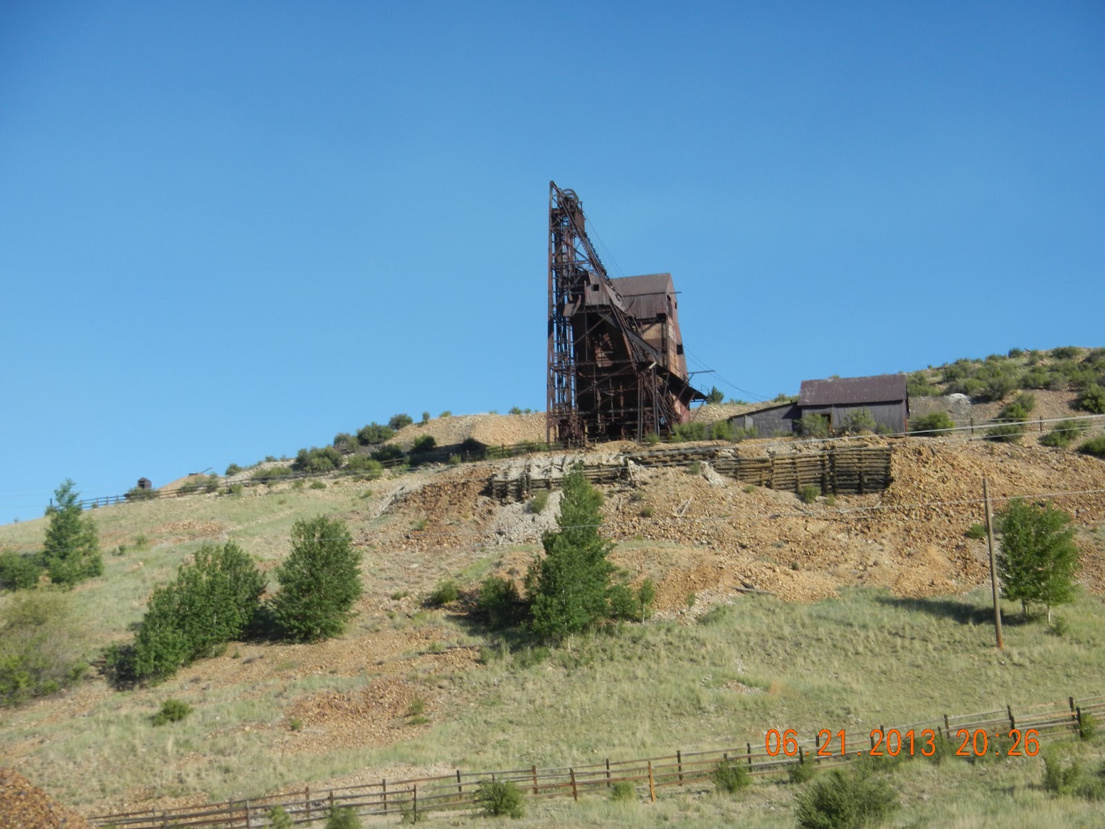
The next landmark on the route was the town of Victor, Colorado which is about 10 miles south of Cripple Creek.  These are often described as "old mining towns," and while that's true, there is still plenty of modern, active mining in the area. 
Mining Operations near Victor, CO
 As I rode across from Cripple Creek to Victor, there were giant valleys and mountains created by these operations.  At one point, I looked up to see a giant vehicle, way at the top of one of these hills.  From a distance it looked like one of those giant Sandcrawler vehicles that the belonged to the Jawas in Star Wars.
Jawas not included!

 Still, even around some of the newer mining endeavors, you could see the remnants of the old mines here and there.
 In the town of Victor, I decided to take a break at Rest Stop #3.  Much like aid stations during a race, the rest stops included a mix of gatorade, water, gels, fruit, and other snacks.  I was still feeling fairly energized, so I opted for just half a banana, and some water before moving on.  I lingered a little longer at this aid station before it dawned on me that I'd only ridden about 23 miles, and I still had another 83 to go!  Time to get moving.
 The ride out of Victor was quite steep and brought us to the high point of the ride after two significant climbs.  One of the things that I came to understand on this ride was that there would be a lot of "give and take" in elevation.  It was common to spend several minutes riding up to the top of a steep hill, only to descend in less than a minute or two.  At the bottom of these descents another hill would be there waiting to be climbed.  As much as possible, I tried to take advantage of the opportunity to coast on the downhill portions so that I could rest my legs for the next hill.  Coasting was fairly easy considering that the pitch on some of these hills was well over 7% meaning that my speed would be in the upper to mid thirties (mph) on the way down.  Contrast that with climbing somewhere between 5-7 mph!
Old Mine on the way up and out of Victor
 Before long, the major climbing of the first half of the ride was finished (well mostly) and we were back in Cripple Creek.  There was one hill in town that was extremely short . . . and extremely steep.  I, underestimated this of course, and didn't get into a low enough gear in time for the climb up.  I wound up having to stand and pedal with all my heart and soul to get to the top without falling over.  After that, the next 10-15 miles was mostly downhill riding back down past the first two rest stops (which I also skipped).  My plan was to ride to the stop at 50 miles before taking a little bit more of a break.  Despite that the ride was mostly downhill, I could feel my energy starting to wane a bit.  What's more, a headwind had picked up, and the smoke from the West Fork Fire complex began to blow our direction.  A smoggy haze enveloped the valley that I was riding through, and there was the campfire smell of smoke in the air.  At the bottom of this valley, I found rest stop #4, and gratefully unclipped from the bike.
The West Fork Fire Complex, a group of several Fires, is clouding much of Southern Colorado
 I spent nearly 10 minutes at this stop to do some major refueling.  The Gatorade, peanut butter and jelly sandwiches, cups of trail mix; all looked and tasted delicious!  I had caught up to a few of the riders that had gone by on their bikes, but most of them were back to riding before me, and I didn't see them again.  The haze and smoke were even more noticeable in this little valley and the sun seemed to beat down even harder.  All of which may have encouraged me to get back on the bike a little sooner than planned.  I wasn't feeling particularly rejuvenated, but there was still half of the ride left.  I steeled myself, and got back on the bike.  The next 8 miles or so were the second longest climb of the day.  In this section, I was definitely in a "dark place."  The hills and the heat were draining all of my will, and it took every last effort to climb.  I've noticed that with longer endurance events, that passing through these psychologically difficult times is fairly common.  I've noticed that they do come and go, it's just a matter of patience.  I gritted my teeth and pushed on.
About a mile out of the rest stop, I noticed a BLM fire vehicle and a couple of pickups parked on the side of the road.  Peeking over the shoulder, it appeared that a small fire had burned a couple of acres at some point.  I imagined that the fire personnel were doing some checking to make sure that it was completely out.  It was a reminder about the fire danger that is present during these hot, dry months.
For the next several miles, I climbed and climbed.  I would reach the top of one hill, only to find another waiting just ahead.  A couple of other riders came past me at one point, and made me feel like I was standing still.  They quickly faded in front of me.  Finally, I reached the top of the climb and a fairly long downhill stretch led to the next rest stop, just a few minutes east of Highway 9.  I stopped to take off my t-shirt and to refill my water bottle, but I chose to make it a quick stop as I worried that stopping too frequently would allow my body to move into rest mode, and make the rest of the ride more difficult.  On to Guffey.
Theme for this ride: Climbing hills!
 The last "segments" of the ride are a bit longer for the most part ranging from 14 to 19 miles.  The first part of the ride up Highway 9 wasn't too terrible.  There was a slight tail wind which made it a bit easier to ride despite the slow steady climb.  I figured that if I could keep that pace, I'd reach the next stop in just over an hour, tops.  However, the last portion of this segment had other ideas.  That's right, there was more climbing to be done, and it was exhausting.  I reached Guffey and the sixth rest stop feeling completely spent after nearly and hour and a half.  I wondered if the SAG wagon would be parked there.  Part of me hoped that it would be.
Standing under the trees at the next rest stop, one of the other riders noted that it was "all kinds of hot" out on the road, and this was a perfect way to describe it.   I drank a half bottle of Gatorade, and refilled my water bottles.   There was an empty camp chair sitting right next to my bike, beckoning me.  I resisted, and finally a fellow rider sat down in it.  I regarded this with an equal mixture of jealousy and relief.  After a slightly longer break, I got back on the bike and faced what was probably the worst climb of the day for me. It was very steep, and while only a couple of miles long, it took me a good twenty agonizing minutes to reach the top.  At several points, it was all I could do to keep even a 3 mph pace, while standing up out of the saddle.  There was also no shade at all, and the unrelenting sun beat down on my back and caused the sweat to pour down from my head.  I couldn't even get a drink of water, as that would have caused me to slow even further, which was pretty much impossible to do.  I pressed on but it was demoralizing and I wondered how on earth I was going to cover another 25 miles  this way.  The time on my bike computer said I'd been riding for about six and a half hours.  I guessed it would be at least nine hours before I finished given the pace I was going.
  With aching legs, I reached the top of the hill and enjoyed some downhill.  I prayed that I would get a few more minutes of descent before the next climb appeared.  In what seemed like a miracle,  the downhill continued, and continued, and continued some more.  Over the next 30 minutes, I enjoyed a long gradual descent and I kept a pace between 25 and 35 mph.  It was a bit of a bumpy ride with ruts in the road about every 40 feet, but I didn't care as long as I continued downhill.  It was absolutely rejuvenating! The next time I checked the distance on my computer I was already at 92 miles.  Only about 15 more to go and I felt great for the first time in a few hours.
The last part of the ride passed quickly even though some of the uphill had returned.  I found a groove and just pushed through each of these hills.  I had energy, speed, and felt like I could ride another 50 miles (not saying that I wanted to, just that I could).  I crossed the 100 mile mark after about seven and a half hours of riding time.  I thought the last six miles would pass slowly and tortuously , but before I knew it, I was on the final hill down into Florissant, and as I rode to the finish, I was greeted with cheers and applause from the other riders and volunteers.
At the Grange Hall, everyone was in good spirits.  There was a BBQ lunch and I greedily enjoyed a cheeseburger, chips, and a drink.  I would have loved a beer, but it wasn't one of the available options, and in reality I don't think it would have been wise with a good 90 mile drive back home.  That said, one of the sponsors for this event was the Paradox Brewery in Woodland Park.  Paradox ages all of their beer in wine casks, and they specialize in adding a modern twist to traditional beer styles.  On the way home,  I stopped in and picked up a 750 ml of their Trippel Double, a Belgian style double IPA to enjoy once  I was safely back at the house.  It was excellent, and not overdone with the typical coriander and orange that a lot of Belgian Whites seem to have.  Let's just say that bottle didn't make it through the night.
 This year, I've opted to participate in some longer events in lieu of the usual round of triathlons (I'm still planning on doing at least a couple) in an effort to build my aerobic base. Back in May I did the CPTR 50 trail run, and next month I'm going to try my hand at a 2.4 mile swim race in Littleton.   This century ride represents my longest bike ride to date.  In terms of exertion, the a century ride seems to be about the equivalent of running a marathon.  I would definitely considering doing this, or another century ride again although I'm not sure about a multi-day cyclingevent.  Maybe with a little more T.I.T.S. (Time in the Saddle), it would be something I'd consider doing, but it's not on the radar for anytime soon.

Thursday, June 20, 2013

MTCC Ride Plan


In two days time, I will embark on the longest and most difficult bike ride that I've ever done.  I am doing a short "taper" this week to get ready, so yesterday I did a brief 1 hour ride on my tri bike.  Now it's down time until the event.  Generally, before a "race,"  I'll come up with a detailed plan for the event so that I'll have a strategy mapped out in advance.  These plans help me to mentally prepare, and they're designed with some flexibility so that I can adapt based on course conditions, the type of race I'm having, etc.  For this event, I've decided to create more of a "ride plan,"  since it isn't a race, and I have absolutely no experience with a formal century ride.  More than anything, this plan will help me to review the course for the race, and to make my best "guess" about how I need to be riding.  As with the CPTR that I did in May, I have no real goal in mind, other than to finish. 
Looks to be acceptable weather for the event.
Course Details:
According to the event web site, the ride I will be doing is 106 miles, although some of the mapping shows it to be closer to 110 (Hey what's another 3-4 miles when you've ridden that far right?).    It also claims about 10,000 feet of elevation gain over the course of the ride with the biggest climb occurring between 10-35 miles or so.  In terms of climbing they break down as follows (classifications are based on what Map My Ride says):
Cat 5:  Two climbs (easiest)
Cat 4: Six climbs
Cat 3: Three climbs
Cat 2: Two climbs
There don't appear to be any Cat 1 or HC climbs (HC meaning too steep to classify).  That said, it doesn't mean that there won't be some gradients that are at least that steep, they just won't have that classification listed because they aren't long enough. Shucks!
The course is basically broken into sections based on the distance between rest stops.  There are 6 total rest stops, and century riders hit some of them more than once.  As a result the ride can be divided into 10 sections total.  Each of these sections varies in length ranging from 7 miles, all the way up to nearly 20 miles.
 Section 1 (Start to rest stop # 1 along CR1):  With a length of 9.5 miles, this section begins with a gradual climb right from the beginning.  At the nearly halfway mark, it switches to an equivalent down hill.  The rest stop at the end marks the turnoff point for century riders who do a loop through the towns of Cripple Creek, Victor, and Goldfield. I will be riding this section a little after 6 in the morning and so it will be the warm-up.  I'll need it for section 2.
Section 2 (Rest stop #1 up to #2):  The next portion of the ride is only 7 miles long.  That said, it appears to have two of the steepest climbs in the event each appearing to be somewhere between 2-3 miles in length.  I'm going to take my time on this part.  It's still very early in the ride so I don't want to finish it exhausted yet having covered only 16 miles total.
Section 3 (Through Cripple Creek to Victor): Shortly after leaving the second rest stop, the ride passes through the town of cripple creek and winds up in Victor, Colorado.  This should be an interesting part of the ride given that I've never visited either Cripple Creek or Victor.  It's always nice to see new scenery.  This section is about 7.3 miles in length with a slight uphill.  Again, I think the key here will be to take my time and conserve energy for the riding later in the day.
Section 4 (Through Victor, Goldfield and back to stop #2):  A 9.8 mile section that continues to climb up to the course high point at just under 10,000 feet in elevation.  Looks like a steep climb, a short downhill, followed by a more gradual climb.  More climbing= more taking it easy.
Section 5 (Back down from rest stop  #2 to rest stop #1): Seven miles of almost complete downhill. Maybe a few rollers, but nothing significant.  I will try to bank a little time here as well as recover from the climbing of the last few hours.
Section 6 (County road 1):  The next 12.6 miles also appear to be a gradual downhill (leading up to the next climbing section of the ride towards the end.  At this point, the course passes from Teller County into Fremont County to the south.  More down hill= more recovery.
Section 7 (Rest stop #4 to Rest stop #5): This is a 10 mile section that looks to be a gradual to moderate climb (looks a little steeper at the end).  There is still some climbing left but this one appears to reach about 9000 feet, the last to do so.  I will be nearing the halfway point for total distance at this point.
Section 8 (Long descent to Rest stop #6):  At 14 miles long, this section is entirely downhill and looks to be the longest descent of the entire ride.  There are a couple of risers along the way, but the end of this section reaches the lowest point on the course (about 7200 feet).  Good place to recover and conserve energy for the last portion of the ride.
Section 9 (Guffey area back to Rest stop #1):  This is a 19.3 mile chunk that starts near Guffey, and involves a fairly steep section of climbing at the beginning.  The rest of the section is a mix of ups and downs along CR's 102 and 112.  Hard to say what I'll be doing here as I cross the threshold into a distance I haven't done before.  Hope to be feeling well.  With a steep start and a long ways to the next station, I will at least be hanging on.
Section 10 (Rest Stop #1 to Finish):  This is the final stretch of 9.5 miles back to the finish area in Florissant.  Just like the first section, only in reverse.  I'm sure by this point, I will be counting the miles!
It's difficult to estimate the amount of time this experience ride will take.  I'm hopeful that even with the climbing, I'll be able to keep an average pace somewhere between 12.5 to 15 mph across the whole ride.   That would be somewhere between 7 to 8.5 hours total which would be in line with some of my longer rides in the mountains.  The big "X factor" is how much slower I will ride after 70 miles since that will be uncharted territory.  I will also need to be mindful of the time I spend at each of the rest stops.  That's an easy way to add an extra 30-45 minutes if one lingers too long.


Sunday, June 16, 2013

Fire Season

Smoky haze from the Royal Gorge Fire on Tuesday evening.
 This morning, the skies over Southern Colorado have returned to their light summer blue.  It's been a tough week for many folks around Colorado Springs.  Something along the lines of nearly 500 homes destroyed from a wildfire that began burning north of the city last week.  There was another that started about the same time just to the south of the Royal Gorge near Canon City.  
Fire damages the park at the Royal Gorge Bridge in June 2013
On Tuesday, I knew something was up when I walked outside around noon.  The air was hazy and you could smell the smoke in the air.  By that evening it had cleared up enough for an  evening bike ride, and as I rode out at the test track, the smoke from both of the wildfires in the area was quite visible, even from nearly 50 miles away.  Strong winds and high temperatures continued for the next several days which hasn't helped the firefighting efforts much.  The drought conditions that have existed in Colorado for the last few years have led to some devastating fires.  It's especially alarming so early in the summer.  If the heat and wind continues, there will certainly be more fires, and more destruction.
Even at over 50 miles away, the smoke from the Black Forest Fire can easily be spotted during an evening ride.
 The sudden loss of a home from something like a wildfire is horrible.  Apart from the financial devastation of losing a house and the belongings,  the psychological impacts are also significant.  Consider the time, effort, and satisfaction that people put into working on their homes, not to mention the fond memories that may have been created there over the years.  The very concept of "home" is associated with feelings of familiarity, comfort, and even safety.  To have that taken away in such a devastating way is traumatic.    In college, I remember a small fire at the house we were renting, which displaced us for a week, and eventually required that we move into a new place.  This was a minor event.  My roommates and I had lived there for only a couple of months and we certainly hadn't done a lot of home improvements.  Furthermore, most of the damage done was "smoke" damage, and none of us lost a lot of personal property.  But even at that, it was an unsettling experience, and I remember feeling very uneasy for several days after the fire as we figured out what to do.  What a tremendously difficult feeling for those who have truly lost something.
This blog is supposed to be about the things that I do for fun.  Mostly it's about my adventures as a very amateur endurance athlete.  In this sense, and on a much smaller and insignificant scale, the fires impact these adventures.  I am lucky in that they are only inconveniences, and not something more devastating to me personally.  For example, the smoke from the fires, along with the prevailing winds, can determine where and whether or not I'm able to train outside.  This weekend, I decided not to go to Colorado Springs for a bike ride up Pikes Peak, because I was concerned that there might be too much smoke in the vicinity.  Even at that, it was difficult figuring out a place to go riding with the fire to the west and some of the road closures (including the highway I rode from Pueblo to Cotopaxi a couple of weeks back) in place.  I finally settled on a familiar route up towards Westcliffe, but as I rode, the fires stayed in my mind.  Along the way, I kept an eye out for any smoke plumes that might be developing.  I wondered what I'd do if a fire were to develop suddenly in the canyon in which I was riding.
Smoke Free: The Rockies as viewed near the top of the pass on the way to Westcliffe
 Wildfires can also affect the races and events in the area.  While the vast majority of races go off without a hitch, it isn't always the case.  This year will mark my fourth year of triathlons.  During that time, I've participated in a total of nine triathlons.   Of those, one was delayed two weeks (Boulder Sunset Triathlon, 2010), one was moved to a different venue (HITS Fort Collins, 2012), and another had its bike course altered (Loveland Lake to Lake, 2012), all due to wildfires.  In other words, about a third of the triathlons that I've done have been impacted in some way by wildfires. I emphasize again that these things mean NOTHING in comparison to those folks that are losing their homes due to wildfires.  More than anything these fires cause me to count my blessings and to think about how fortunate I am to have what I have, and to be able to continue doing the things that I love to do.  

Sunday, June 9, 2013

"North" Colorado


This weekend we are up visiting my parents in "North Colorado."  Sometimes being up here feels like being in a whole different state compared to Pueblo (HA!).  With the MTCC Experience Ride just a couple of weeks away, I brought my bike along to get an early morning ride done.  I wanted to get some time up in the mountains again, since I haven't done a ride with that kind of challenge for a couple of weeks.   A look at the elevation profile for the upcoming MTCC ride indicates a fairly challenging course.  I hope that I haven't bitten off more than I can chew, although I will be surprised if the ride is more difficult than the ultra I did last month. Since this is my first century ride I plan on taking my time, and not hesitating to take a break here and there.
Elevation Map for MTCC
This morning, I left the house a few minutes before six and drove west over to Loveland.  After parking the car, I pointed my front wheel towards the mountains and began riding.  The route up the Big Thompson Canyon is fairly tame.  There are a few steep portions, but nothing unmanageable at all.  I hadn't really realized that the distance between Loveland and Estes Park was so short, but it really isn't more than about 25 miles each way. It was a pleasant ride this morning with no wind and cool temperatures.
The ride up and down from Estes
 As a kid I spent some time in this canyon, and a trip to Estes Park was an annual event.  The Canyon is probably most famous for the horrendous flood that occurred on the evening of July 31st, 1976.  After heavy rains, a wall of water came roaring down the canyon destroying everything in its path.  More than 140 people were killed in the flood and it remains the worst natural disaster ever to hit Colorado.  I was only about 5 years old at the time, but I can remember listening to my dad's ham radio in the basement of our home (the ham radio operators in the area were utilized to provide communications support for the emergency efforts).  Within the canyon walls, there's little trace of the damage now aside from a few memorials placed along the highway.   Still, as you ride up the canyon, it's hard not to think about the flood and the impact that it had.
The Flood quickly devastated the canyon. 
As I ride, I manage a steady pace.  Nothing too fast, but nothing too slow, either.  I do my best to attack the steeper parts, and apart from a moment here and there where my energy wanes, I feel good for the majority of the ride.  And then, before I know it, I crest a hill and after a short descent, the city limit sign of Estes Park comes into view.  I've made it.  My initial urge is to ride all the way into town and go to the saltwater taffy store or maybe grab a slice of pizza.  However, the reality is that it's only about 8:30 in the morning, and it will probably be another couple of hours before the stores open.  What's more, I have my family waiting for me at home, so it's time to turn around and head back down the canyon.  Prior to leaving, I snap a couple of pictures on the edge of town.  One of the great things about living in Colorado is the spectacular scenery that the Rockies provide.  I am very blessed to live in this part of the world.
The view from Estes Park
The ride back down to Loveland is uneventful and takes about half of the time that the ride up did.   As I head back down, it looks like the majority of cyclists are starting on their way up.  I pause a  couple of times on the ride down to enjoy the scenery, and it strikes me as I'm riding that summertime has truly arrived!


Sunday, June 2, 2013

"Fit to be Ride"


 After a month of weekend travels, it was nice to have some down time on Saturday and Sunday and to just enjoy being at home.  This weekend I finally had the chance to get a proper fitting done on my triathlon bike.  There aren't a lot of options in town, but last week I rang up our LBS and got set up to have a fitting done on Saturday afternoon.  The shop uses the bg FIT system by Specialized, and I've used them in the past so I knew that I would get a quality fitting done, and they'd be able to dial in the bike so that it would fit me just right.  At 3:00 p.m. on Saturday, I took my bike over to the shop and met with Charles, who would be doing the fitting for me.  We started with some general discussion around the type/ distance that I would be riding.  After that we spent several minutes looking at different aspects of my posture, flexibility, etc.  Charles explained that having an understanding of these things would help as we began making adjustments to my bike.  For example, for a tall guy, I'm okay at bending forward and touching my toes, but most of the flexibility is in my lower back,  I lack a fair amount of flexibility in my hamstring muscles. Therefore, it's important that the bike is adjusted so that I'm not super extended on the lower end of the pedal rotation as that can cause more strain on my hamstrings and negatively impact my riding over a longer period of time.  Understanding these aspects of posture and flexibility was extremely helpful and Charles was also able to suggest some different stretches that I could do to help with areas where I demonstrated less flexibility. 
A stretchy-stretch for sure!
The second part of the fitting involved a lot of this:
1) Get on the bike
2) Ride for a bit
3) Stop and measure
4) Get off the bike
5) Wait while adjustments are made
6) Go back to step 1

There were a number of adjustments that had to be done to the bike in order to get a decent fit.  For starters, the height of the seat, its angle, and its position forward had to be adjusted.  When I initially got on the bike the nose was pointed quite a ways downward, and as a result, I kept slipping forward which put a tremendous amount of pressure on my arms.  I was literally pushing myself back up onto the seat.   Not good. Once this was leveled out, the bike immediately became much more comfortable, and easier to ride.  Moving the seat back and adjusting the height took a little more work, but with each adjustment, the bike became more comfortable to ride.  This process probably took close to an hour to complete.
A bit blurry but you get the idea.
A little more forward, arms at a more horizontal level, head slightly lower
 Once the back part of the bike was set up, the next step was to begin making adjustments to the headset.  I had originally installed the headset onto the stem just to get a sense of what the bike would look like, but I hadn't done any measuring.  After trying a few things, we wound up rotating the handlebars upwards a touch.  This made it much easier to reach the brake levers on the end of the bullhorns.  With that in place we started working on the aero bars.  The first thing we did was to widen them slightly.  They came set up in an extremely narrow position which made the bike feel unstable.  They were to the point that this position would have made it harder to breathe deeply while riding, which in turn, would probably have a bigger impact on my performance than the slight decrease in aerodynamics.  Even with the adjustment, the bars are still quite a bit narrower than those on my road bike.  We also moved the bars backward slightly, which put me into a more comfortable position, and made me feel less sprawled across the bike.  With a few more adjustments, and a few turns of the torque wrench, we finished up and the bike was set to go.  I would guess that the fitting took about 2 1/2 hours total. 
 On Sunday morning I drove out to the test track road for my inaugural ride and at 8:00 a.m., I clipped in and headed east.  This was the first time I'd ridden a triathlon bike, and only the second time, I'd used a carbon frame.  As I set out, two things immediately came to my attention. First, compared to my roadie, this bike is much twitchier up front.  Kind of like the difference between steering a speedboat vs. a yacht.  Throughout this first ride, I found myself weaving a bit more across the shoulder of the road.   On my road bike, a tap of the handlebars either way, results in a gradual adjustment.  With this bike the same movement produces a faster, more responsive change in direction.   It was much easier to manage once I ducked into the aero bars, but it will take some getting used to.  The bike was responsive in other ways as well.  For example, when I chose to accelerate, the bike did not hesitate.  After the first 20 miles or so, I really started to notice this.  As I rode up a couple of hills, I put a little extra in and picked up the pace.  When I do that on the road bike, there's usually a slow begruding acceleration that occurs.  It takes a moment or two to move faster, which can be a killer when going up a hill.  "My Boy Blue" on the other hand jumped right into it, and I added an mph or two easily. 

The second thing I noticed was how different the ride felt.  My roadie is an aluminum frame, and most bumps and creases in the road are telegraphed directly to the butt on the seat and the hands on the handlebars.  No subtlety whatsoever. The dampening effect of the carbon made these bumps much less jarring.  I still knew there were there, but it was a decidedly less bumpy experience.  I imagine there will be a great benefit to this over longer rides in terms of feeling less battered from all of the "textures" in the road.  I also noticed that I was a fair bit faster on this bike.  People often talk about the 1 to 2 mph advantage that you get from a triathlon bike, and that was certainly the case for me.  Given my excitement about this first ride, I know that I may have been pushing a bit harder today, but I don't think that's attributable only to my enthusiasm for my new ride.  I covered the 34.1 miles out and back with an average pace of 20.1 mph.  Not exactly screaming, but there was a pretty good headwind on the return trip.  Compare that to a couple of weeks ago when I rode a similar distance (33 miles) and averaged about 17.4 mph.  That ride had a similar headwind to today.  
Data from a May 18th ride
The ride felt good too.  I had a touch of numbness here and there, but I'm fairly certain that's just from riding with a slightly different set up than I'm used to.  Nothing on the ride made me feel particularly uncomfortable, and although my neck felt a little tight afterward, I haven't been riding in the aero position much lately, so doing that for 90 plus minutes had more to do with that than anything else I'd imagine. 
Data from June 2nd
Next weekend, we are headed up north to visit my folks.  I do need to get a ride in, but I plan on taking my "roadie" for the weekend.  If I can swing it, I hope to ride from Loveland up to Estes Park and back.  This may be my last chance to get a mountain ride in before the Mountain Top Experience ride in 3 weeks.